Aviation Weather for Drone Operations
February 23, 2023There are two types of weather sources for the drone pilot. METARS and TAFS are used by aviation pilots to get up to date weather information. A METAR is a long string of text which needs to be decoded and translated to know what weather is in your area. A METAR is a French acronym which, when translated means “Routine Surface Observation”. METARS can be found on the NOAA web site “AVIATIONWEATHER.GOV”
The “METAR” or Meteorological Terminal Air Report
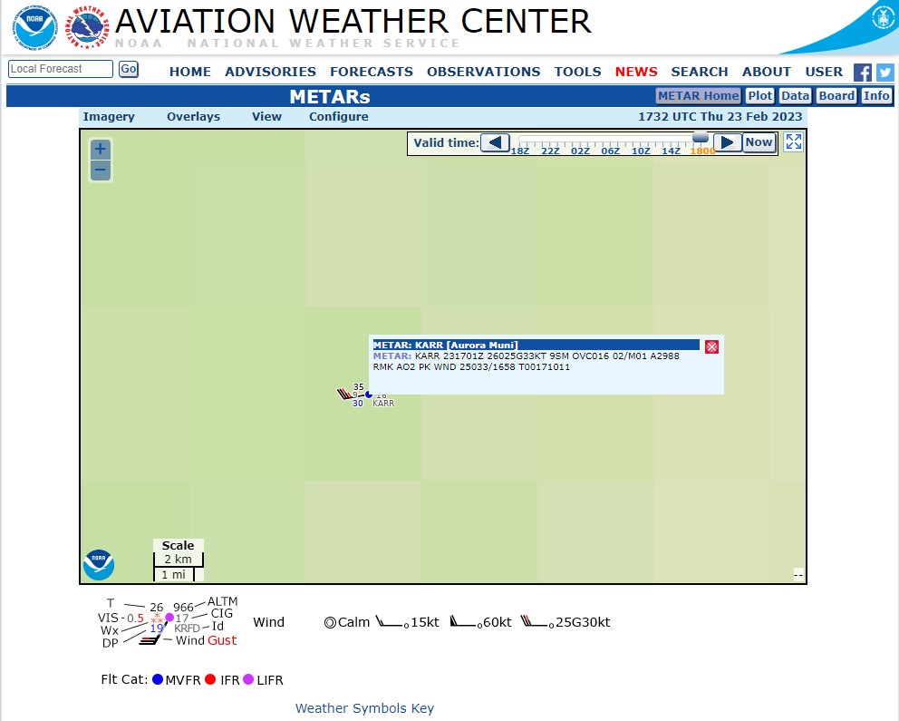
METAR strings are issued 55 minutes past each hour. For Instance:
METAR: KARR 231701Z 26025G33KT 9SM BKN009 OVC016CB 02/M01
A2988 RMK AO2 PK WND 25033/1658 T00171011
KARR – Station ID for Aurora Municipal Airport
231701Z – Prepared on the 23rd at 1701 Zulu (UTC)
(Aurora is UTC offset -6 hrs.) 1701 would be 11:00 a.m. local time.
26025G33KT – Winds are from 260 at 25 Knots gusting to 33 Knots
9SM – Visibility 9 Statute Miles
BKN008 – Ceiling 800ft broken
OVC016CB – 1,600ft Overcast, Cumulonimbus
02/M01 – Temperature 2 degrees Celsius, Dewpoint 1 degrees Celsius
A2988 – Altimeter 29.88
RMK – Remarks
AO2 – Station has automatic precipitation
PK WND 25033/1658 – Peak Winds 25 to 33 Knots
T00171011 – Exact Temperature 1.7, Exact Dewpoint 1.1

Typical METAR Abbreviations
VC = In the Vicinity
MI = Shallow
PR = Partial
BC = Patches
DR = Low Drifting
BL = Blowing
SH = Shower(s)
TS = Thunderstorm
FZ = Freezing
DZ = Drizzle
RA = Rain
SN = Snow
SG = Snow Grains
IC = Ice Crystals
PL = Ice Pellets
GR = Hail
GS = Small Hail and/or Snow Pellets
UP = Unknown Precipitation
BR = Mist
FG = Fog
FU = Smoke
VA = Volcanic Ash
DU = Widespread Dust
SA = Sand
HZ = Haze
PY = Spray
PO = Well-Developed Dust/Sand Whirls
SQ = Squalls
FC = Funnel Cloud Tornado Waterspout
SS = Sand storm
DS = Dust storm
METARS and ZULU Time
When going to AVIATIONWEATHER.GOV, it is easy to click on the METAR button, then browse to the lower right portion of the screen and enter the known airport identifier, for example KARR or KORD. Note that not every airport produces weather and METARS. METAR time is based on Zulu time, which occurs at the prime meridian – zero degrees longitude – running through Greenwich, UK. Zulu time, which is used for military and aviation purposes, formerly known as Greenwich mean time, is now based on UTC – known as Coordinated Universal Time. The premise behind Zulu time is that universally the same time no matter where you are located on the globe.
METAR Cloud Descriptions
METARS contain various cloud descriptions. “Overcast” or OVC refers to a cloud condition containing a continuous layer of cloud cover. “Broken” or BKN means there are some openings within the clouds allowing some sun penetration. “Scattered” or SCT means the clouds are substantially open in many areas allowing sunlight to penetrate. “Few” or FEW means literally that there are only a few clouds in the sky, and “Clear” or CLR means little or no clouds.
The “TAF” or Terminal Aerodrome Forecast
TAF stands for Terminal Aerodrome Forecast. A TAF takes the METAR data one step further in that provides a forecast on how the weather may develop. TAF codes look much loke METAR codes but are much longer and rather than giving just one time, will provide a range of time, for instance 24 hours, from which the weather will be predicted. A TAF will only affect an area of 6 statute miles.
The “HEMS” tool for drone pilots
“HEMS” is yet another acronym for Helicopter Emergency Medical Services Tool. The HEMS toll was originally designed for life flight helicopters which would usually fly low, visit an accident scene, then fly low to a hospital roof landing pad. The HEMS tool fills the void for low flying aircraft weather conditions. The HEMS tool can also be found on AVIATIONWEATHER.GOV.